English
 norsk
norskBlar i forfatter "Nilsen, Lennart"
Viser treff 1-16 av 16
-
Assessing local acceptance of protected area management using public participation GIS (PPGIS)
(Journal article; Tidsskriftartikkel; Peer reviewed, 2017-12-14)Protected area management can be highly contentious. Information about the acceptability of conservation actions can help environmental authorities design policies that are accepted locally, and identify potential areas of conflict between land users and conservation objectives. In this study, we implemented a spatially-explicit method for eliciting public preferences for land use and conservation ... -
Chronological changes in soil biogeochemical properties of the glacier foreland of Midtre Lovénbreen, Svalbard, attributed to soil-forming factors
(Journal article; Tidsskriftartikkel; Peer reviewed, 2022-02-21)Glacier forelands provide an excellent opportunity to investigate vegetation succession and soil development along the chronosequence; however, there are few studies on soil biogeochemical changes from environmental factors, aside from time. This study aimed to investigate soil development and biogeochemical changes in the glacier foreland of Midtre Lov ́enbreen, Svalbard, by considering various ... -
Correction: Anderson, H.B. et al. Using Ordinary Digital Cameras in Place of Near-Infrared Sensors to Derive Vegetation Indices for Phenology Studies of High Arctic Vegetation. Remote Sens. 2016, 8, 847
(Journal article; Tidsskriftartikkel; Peer reviewed, 2017-09-28)After the publication of the research paper by Anderson et al. [ 1 ], a reanalysis of the data showed that mistakes had been introduced in the calculation of the greenness indices and the filtering for outliers prior to the statistical analysis. The calculation of the 2G_RBi and Channel G% indices were the most affected, while the filtering of the data for outliers had inadvertently removed too ... -
A distributed time-lapse camera network to track vegetation phenology with high temporal detail and at varying scales
(Journal article; Tidsskriftartikkel; Peer reviewed, 2021-07-29)Near-surface remote sensing techniques are essential monitoring tools to provide spatial and temporal resolutions beyond the capabilities of orbital methods. This high level of detail is especially helpful to monitor specific plant communities and to accurately time the phenological stages of vegetation – which satellites can miss by days or weeks in frequently clouded areas such as the Arctic. In ... -
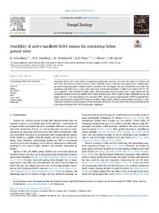
Feasibility of active handheld NDVI sensors for monitoring of lichen ground cover
(Journal article; Tidsskriftartikkel; Peer reviewed, 2023-03-04)Vegetation indices are corner stones in vegetation monitoring. However, previous field studies on lichens and NDVI have been based on passive sensors. Active handheld sensors, with their own light sources, enables high- precision monitoring under variable ambient conditions. We investigated the use of handheld sensor NDVI for monitoring pale lichen cover across three study sites from boreal heathlands ... -
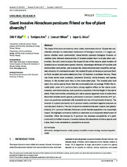
Giant invasive Heracleum persicum: Friend or foe of plant diversity?
(Journal article; Tidsskriftartikkel; Peer reviewed, 2017-05-30)The impact of invasion on diversity varies widely and remains elusive. Despite the con- siderable attempts to understand mechanisms of biological invasion, it is largely un- known whether some communities’ characteristics promote biological invasion, or whether some inherent characteristics of invaders enable them to ... -
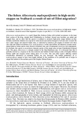
The lichen Allocetraria madreporiformis in high-arctic steppes on Svalbard: a result of out-of-Tibet migration?
(Journal article; Tidsskriftartikkel; Peer reviewed, 2018-01-29)<i>Allocetraria madreporiformis</i> is a small, finger-like, fruticose lichen with isolated occurrences in the inner fiord section of the long, straight fiord Wijdefjorden in Svalbard. Several new localities are added and mapped here, and we show that the species is confined to exclusive high-arctic steppe habitats on finetextured, moderately alkaline soil, exposed to wind erosion and aeolian transport ... -
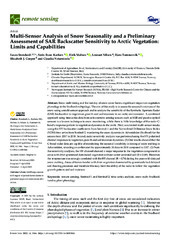
Multi-Sensor Analysis of Snow Seasonality and a Preliminary Assessment of SAR Backscatter Sensitivity to Arctic Vegetation: Limits and Capabilities
(Journal article; Tidsskriftartikkel; Peer reviewed, 2022-04-13)Snow melt timing and the last day of snow cover have a significant impact on vegetation phenology in the Svalbard archipelago. The aim of this study is to assess the seasonal variations of the snow using a multi-sensor approach and to analyze the sensitivity of the Synthetic Aperture Radar (SAR) backscatter to vegetation growth and soil moisture in an arctic environment. A combined approach using ... -
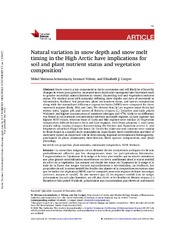
Natural variation in snow depth and snow melt timing in the High Arctic have implications for soil and plant nutrient status and vegetation composition
(Journal article; Tidsskriftartikkel; Peer reviewed, 2022-02-16)Snow cover is a key component in Arctic ecosystems and will likely be affected by changes in winter precipitation. Increased snow depth and consequent later snowmelt leads to greater microbial mineralization in winter, improving soil and vegetation nutrient status. We studied areas with naturally differing snow depths and date of snowmelt in Adventdalen, Svalbard. Soil properties, plant leaf ... -
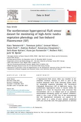
The northernmost hyperspectral FLoX sensor dataset for monitoring of high-Arctic tundra vegetation phenology and Sun-Induced Fluorescence (SIF)
(Journal article; Tidsskriftartikkel; Peer reviewed, 2023-09-16)A hyperspectral field sensor (FloX) was installed in Adventdalen (Svalbard, Norway) in 2019 as part of the Svalbard Integrated Arctic Earth Observing System (SIOS) for monitoring vegetation phenology and Sun-Induced Chlorophyll Fluorescence (SIF) of high-Arctic tundra. This northernmost hyperspectral sensor is located within the footprint of a tower for long-term eddy covariance flux measurements ... -
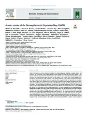
A raster version of the Circumpolar Arctic Vegetation Map (CAVM)
(Journal article; Tidsskriftartikkel; Peer reviewed, 2019-07-17)Land cover maps are the basic data layer required for understanding and modeling ecological patterns and processes. The Circumpolar Arctic Vegetation Map (CAVM), produced in 2003, has been widely used as a base map for studies in the arctic tundra biome. However, the relatively coarse resolution and vector format of the map were not compatible with many other data sets. We present a new version of ... -
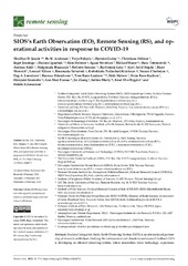
SIOS’s Earth Observation (EO), Remote Sensing (RS), and operational activities in response to COVID-19
(Journal article; Tidsskriftartikkel; Peer reviewed, 2021-02-15)Svalbard Integrated Arctic Earth Observing System (SIOS) is an international partnership of research institutions studying the environment and climate in and around Svalbard. SIOS is developing an efficient observing system, where researchers share technology, experience, and data, work together to close knowledge gaps, and decrease the environmental footprint of science. SIOS maintains and facilitates ... -
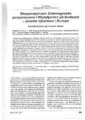
Stepperøyrkvein Calamagrostis purpurascens i Wijdefjorden på Svalbard - einaste lokalitetar i Europa
(Journal article; Tidsskriftartikkel; Peer reviewed, 2016-12-24) -
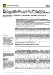
Time-series of cloud-free sentinel-2 ndvi data used in mapping the onset of growth of central Spitsbergen, Svalbard
(Journal article; Tidsskriftartikkel; Peer reviewed, 2021-08-02)The Arctic is a region that is expected to experience a high increase in temperature. Changes in the timing of phenological phases, such as the onset of growth (as observed by remote sensing), is a sensitive bio-indicator of climate change. In this paper, the study area was the central part of Spitsbergen, Svalbard, located between 77.28°N and 78.44°N. The goals of this study were: (1) to prepare, ... -
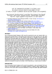
Use of unmanned aircraft systems (UAS) in a multi-scale vegetation index study of arctic plant communities in Adventdalen on Svalbard
(Journal article; Tidsskriftartikkel; Peer reviewed, 2014)Use of Unmanned Aircraft Systems (UAS) gives the opportunity to carry out research with a re-duced environmental footprint. Unmanned aircraft, including both fixed wing and multi rotor types (helicopters) allow us to collect very high resolution image data for vegetation mapping without the need for any personnel walking into the site and thereby potentially disturbing the sensitive Arctic ecosystems. ... -
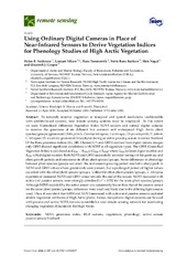
Using Ordinary Digital Cameras in Place of Near-Infrared Sensors to Derive Vegetation Indices for Phenology Studies of High Arctic Vegetation
(Journal article; Tidsskriftartikkel; Peer reviewed, 2016)To remotely monitor vegetation at temporal and spatial resolutions unobtainable with satellite-based systems, near remote sensing systems must be employed. To this extent we used Normalized Difference Vegetation Index NDVI sensors and normal digital cameras to monitor the greenness of six different but common and widespread High Arctic plant species/groups (graminoid/Salix polaris; Cassiope tetragona; ...